Page 416 - 1915, Springs of CA.
P. 416
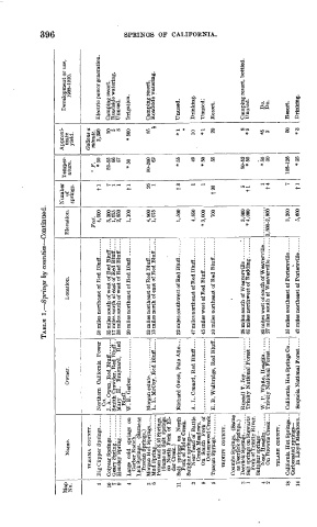
TABLE  1. Springs by counties Continued.                                 Co
                                                                                                                       CD
                                                                               Number  Temper-  Approxi-
         Map      Name.            Owner.               Location.      Elevation.  of        mate    Development or use,
         No.                                                                   springs.  ature.  yield.  1908-1910.
               TEHAMA  COUNTY.                                                              Gallons a
                                                                         Feet.        o  p^  minute.
           1                                                              4,000   tl    * 50  2,250  Electric power generation.
                              Co.
           10                J.A.Owen, Red Blufl...... 35 miles south of west of Red Bluff. ....  3,300  7  52-55  10  Camping resort.
           7                 Smith Crowder, Red Blufl. . 17 miles south of east of Red Blufl. ....  1,075  1  66  5  Roadside watering.
           9                                   38 miles south of west of Red Blufl. ....  2,850  1  57  8  Unused.
                              Blufl.
           4                                   20 miles northeast of Red Bluff  .......  1,100  tl  *50  *500  Irrigation.
              Gerber Ranch.
             Lick Springs.  (Same as
              Tuscan Springs.)
                                                                          4,800   26  90-200    85  Camping resort.
           6                 L. L. McCoy, Red Bluff..... 13 miles north of east of Red Bluff. . ...  1,075  1  62  »  Roadside watering.
             Poison and Kid Springs.
               (Same as Salt  springs
              on  North  Fork of  El-
              der Creek.)
                                               32 miles southwest of Red Bluff. .......  1,500  t3  *55  *1  Unused.
               Fork of Elder Creek.
             Sulphur springs-
                                               47 miles northeast of Red Bluff. ........  4,850  1  49  10  Drinking.
                 Creek Meadows.
                                               45 miles west of Red Blufl. ............  *3,000  1  *50  *1  Unused;
                 Cottonwood Creek.
           5                 E. B. Walbridge, Red Bluff. 10 miles northeast of Red Bluff........  700  f20  55  20  Resort.
               TRINITY  COUNTY.
             Coumbs Springs.  (Same
               as Deerlick Springs.)
           3                                   28 miles south of Weaverrille ........'.  3,000  5  50-52  8  Camping resort, bottled.
                                                                          * 4,000  tl   *50    *5  Unused.
               Fork of Trinity River.
              Sulphur springs
                             W. P. White, Hoaglin. .  ....                         1    *50    *5     Do.
                On Browns Creek                                        2,800-2,900  t4   50     2     Do.
                TULAEE  COUNTY.
           1 o                                                             3,200   7  105-126   50  Resort.
              Carbonated springs
           14   In Llovd Meadows. . Seauoia National Forest .... 42 miles northeast of Portersville ......  5,600  tl  *55  *3  Drinking.

